BUTLER PEAK
About a half hour drive on dirt roads
Difficulty Level – 2 or 4 wheel drive vehicle with good ground clearance.
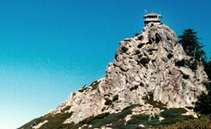
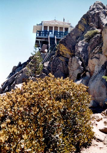
Isolated in the middle of the San Bernardino mountain range, approximately midway between Lake Arrowhead and Big Bear Lake sits Butler Peak. It is one of my favorite places in the San Bernardino Mountains. Many years ago the Forest Service cut a road into this remote location, and built the Butler Peak fire lookout tower that is manned by volunteer hosts from the National Forest Association. To say that the views from this tower are breath taking is an understatement. At 8,537 feet high, this incredible vantage point provides a 360 degree view of not just the San Bernardino forest, but what seems like all of Southern California and beyond. Laid out before you is a vista that includes Lake Arrowhead, Big Bear Lake, San Gorgonio mountain, Holcomb Valley, San Bernardino, Los Angeles, and on a clear day, even Catalina. Butler Peak is an experience that you are not going forget.
As remotely located in the San Bernardino wilderness as it is, you can drive to within a hundred yards of the fire lookout tower. A four wheel drive vehicle is recommended but a 2 wheel drive vehicle with good ground clearance is usually adequate. As always, a visit to the Big Bear Discovery Center to purchase an Adventure Pass, pick up maps, and get updates on the latest forest conditions should be your first stop before heading into the wilderness.
INTO THE WILDERNESS
The Butler Peak safari begins by taking North Shore Drive (Hwy38) on the north side of Big Bear Lake to Fawnskin. Once in Fawnskin, turn north on to USFS Road 3N14 (Rim Of The World Drive). As the street sign indicates, 3N14 was once a part of the original Rim Of The World Highway into Big Bear. The total drive time to Butler Peak from Fawnskin is about 25 to 30 minutes. Check out the History section at the bottom of this page for additional information on this highway that had a major influence on our local Big Bear history.

From left to right cameraman Josh Patterson, hosts Kim & Tim Sweet get ready to film an history Show episode for Channel-6 Big Bear from the deck of the Butler Peak fire lookout tower. © Rick Keppler
About a mile in on 3N14, turn west (left) on to USFS 2N68. As you head west on 2N68, keep in mind that you are still on the old Rim Of The World Highway, and that this road is probably in better condition today than it was back in 1915. It is hard to imagine that this was once called a highway, but this is how people use to travel to Big Bear.
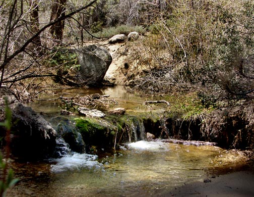
2N68 eventually crosses a small stream that usually flows year round. A few minutes after that we reach the USFS 2N13 junction. At this point, make sure that you turn left (south) on to 2N13C which puts us on the final leg of our trip to Butler Peak. Note that a right turn on to 2N13 would allow you to continue on the old Rim Of The World Highway towards Green Valley lake. This is another interesting little excursion that we will cover in another article.
As 2N13C climbs higher and higher in a south/west direction towards Butler Peak, it constantly reveals scenic views of the valleys on the north side of the San Bernardino Mountains, as you look out towards the high desert. Your journey on 2N13C ends at Butler Peak. Parking is available at a trail head for the short hike up to the fire lookout tower.
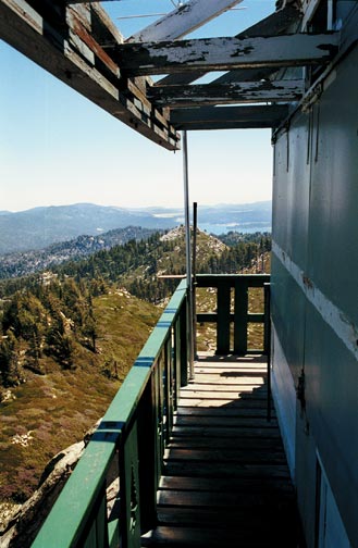
If heights make you uncomfortable, you might want to think twice about climbing up onto the lookout tower deck. It is suspended out over the canyon with literally nothing under you for hundreds of feet, providing the exhilarating feeling of standing on top of the world. Look east and you will see Big Bear Lake. To the east is Lake Arrowhead. To the north is San Gorgonio, and to the south is Holcomb Valley and the High Desert.
If the tower is open, be sure to sign the guest register. The volunteers on tower duty are usually more than happy to provide information, and answer questions on the more interesting sights.
Happy Trails.

The Fire Lookout Tower at Butler Peak. Highway 18 from Running Springs to the Big Bear Lake Dam can be seen at the lower left. © Rick Keppler

The view towards Los Angeles from Butler Peak lookout tower. San Bernardino, underneath the cloud cover, is getting some rain. © Rick Keppler
“RIM OF THE WORLD HIGHWAY” HISTORY.
When the rock dam at Big Bear was built in 1885, it created a new lake at the east end of the San Bernardino Mountains, that began attracting tourists like a magnet. Unfortunately the only way to get to this new lake was by making a two or three day journey on some ancient dirt roads or trails left over from the mining days.
In 1888, three years after the rock dam was built, two local Big Bear ranchers Gus Knight and John Metcalf, decided to build a resort hotel for those brave tourists that were determined enough to make all the way to the new lake at Big Bear. The resort they built was called the Bear Valley Hotel, and despite all the problems in getting to Big Bear, it hotel was an immediate success.
A few years later in 1891, Knight and Metcalf incorporated the Bear Valley Wagon Road Company, and built a toll road from Fawnskin through Holcomb Valley to Green Valley Lake where it connected with existing toll roads which had been built years earlier by the lumber companies.

The Bear Valley Toll Road was built by Big Bear ranchers Gus Knight and John Metcalf. It later became part of the Rim Of The World Highway. - Rick Keppler collection.
The new Bear Valley Wagon Road allowed travelers to travel all the way to Big Bear in the comfort of a wagon, and it reduced the travel time from San Bernardino to just 1 1/2 days.
In 1915, San Bernardino County took over all of the old toll roads and combined them into a single dirt, but well maintained highway through the San Bernardino mountains. It was known as the Rim Of The World highway. As a result, Fawnskin started growing quickly and was on it’s way to becoming the main population center, because this is where the new highway entered Big Bear valley. But this all changed in 1924, when the section of highway from Green Valley to Fawnskin was abandoned by San Bernardino County, and replaced by today’s Highway 18 from Running Springs to the dam, which then ran along the south shore to the Big Bear Village. As a result, growth in Fawnskin slowed to a crawl, and Big Bear Village began to evolve as the community center of Big Bear valley.
Keep in mind that when you drive the route to Butler Peak as described on this page, you are stepping back in time and traveling the old Bear Valley Wagon Road to Big Bear and later the Rim Of The World highway as it existed back in the late 1800’s and early 1900’s.

The Rim Of The World Highway entered Big Bear Valley at Fawnskin which in the early 1920's was rapidly growing into a major population center. - Rick Keppler collection.
For more information on the history of early roads into Big Bear, check out the Big Bear History Site.Com or go to the Channel-6 website program guide. Here you will find the dates and times for the various historical episodes on Channel-6’s Big Bear History Show.
___________________________________________
___________________________________________
___________________________________________
If you plan on visiting Big Bear Lake, check out Big Bear Cabins and Coupons .Com. “Cabins and Coupons” has downloadable discount coupons for Dining Out and Shopping with Big Bear merchants. They also have lodges & privately owned cabins for rent of every size and flavor if your looking for a place to stay.


Comments are closed.